
🍂 Autumn Routes in Asturias — Rutas de Otoño en Asturias
A selection of beautiful trails for a golden autumn: beech forests, gorges, waterfalls, and nature reserves. All routes are equipped with starting points on Google Maps and tracks on Wikiloc.
🍁 Bosque del Gumial (Aller)
Brief: loop ~6.8–9 km; elevation ~500–540 m; 2–3 hours at a moderate pace. Suitable for families; dogs on a leash are allowed. Trail marking PR-AS 48 is found at key junctions.
Why in autumn: Gumial is one of the most “fairy-tale” beech forests in central Asturias. The moist soil, mossy stones, golden crowns, and the sound of streams create a cinematic atmosphere.
- Start/Parking: El Fielato (AS-253). Limited spaces — arrive early.
- Surface: forest and shepherd trails, clay/stone; slippery when wet.
- Options: ascent to Peña del Alba (adds km and elevation).
- Equipment: boots with good tread, poles for descent, light rain jacket.
%2007.jpg)
🍁 Foces del Río Pendón (Nava)
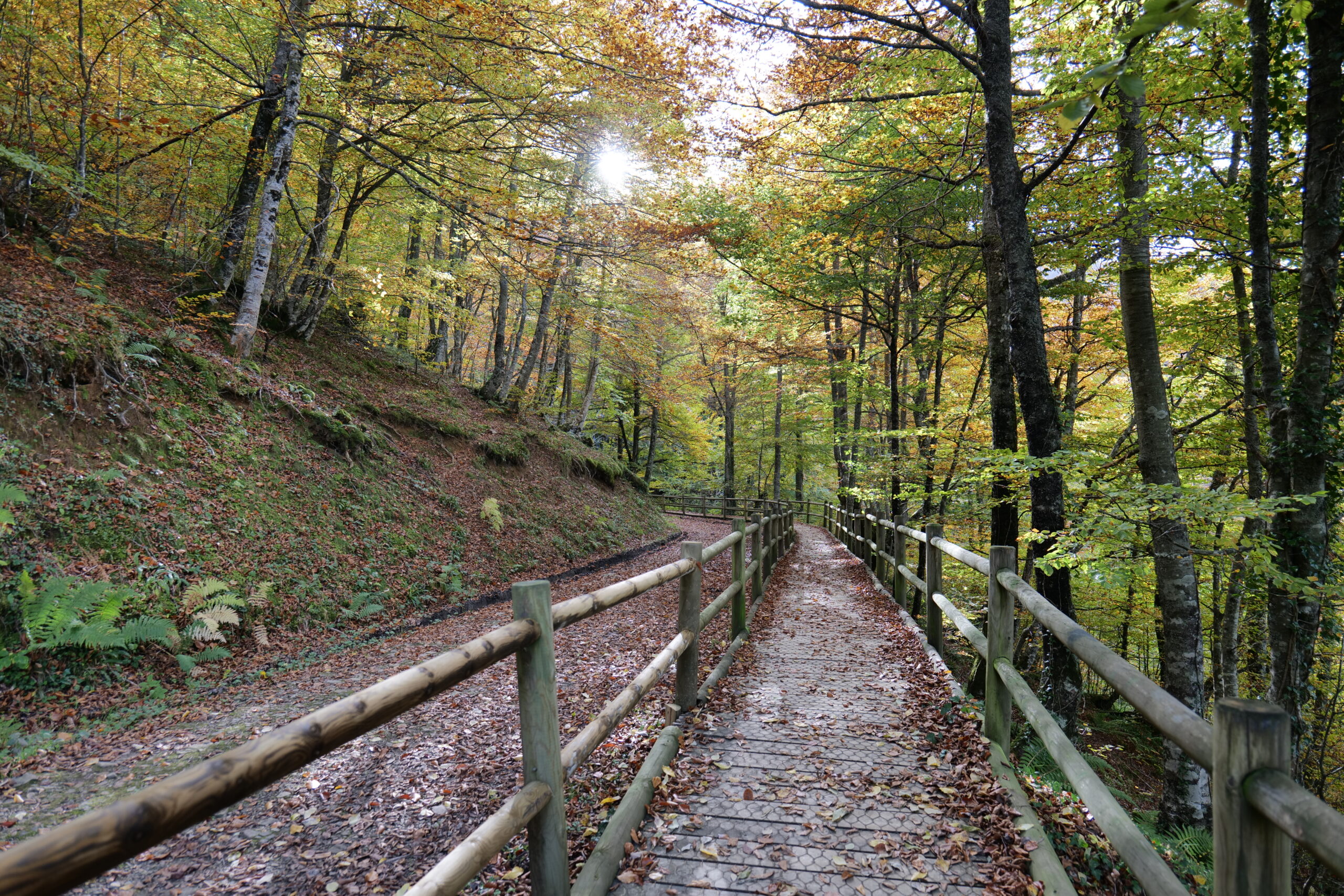
Brief: loop ~9 km; elevation gain ~400–450 m; 2–3 hours. An easy and very picturesque canyon with walkways and shady floodplain forest — a great choice for the first “autumn” outing.
Route: start in the area of the Fuensanta spring/water plant. The trail goes through a narrow gorge with wooden crossings over streams, then into a wider forest section. Watch the trail carefully among the foliage.
- With children: yes; hold hands near the walkways.
- With dogs: on a leash (livestock and other groups may be encountered).
- After rain: stones and roots are very slippery.

🍁 Hayedo de la Biescona (Sierra del Sueve)
Brief: loop ~7.5–8 km; elevation gain ~200–450 m; 2–3 hours. One of the lowest located beech forests by the sea. Peak coloring late (often late November) due to the mild maritime microclimate.
Route: popular starting point — the surroundings of Casa Julia (Pie de Potru, AS-260). The trail runs along a stream with small crossings, then goes into the beech grove. Optionally, it can be connected with the viewpoint Mirador del Fitu or ascents along the Sueve ridge.
- Surface: deep leaf litter, occasionally wet “steps”.
- Photo: best on a cloudy day — even light.
- Families/dogs: yes; supervise children near streams.

🍁 Foz de Moñacos (Caso)
Brief: loop ~11.6 km; elevation gain ~800–850 m; 3–4 hours; moderate difficulty due to elevation gain and rocky sections. Well combined with the La Pesanca area (beautiful valley and picnic tables).
Route: from the La Pesanca parking lot, the trail enters a narrowing canyon (“foz”), where the stream is particularly noisy after rains. Then — a noticeable ascent through the forest and a return loop. In the afternoon, the gorge quickly darkens.
- Shoes: waterproof boots; poles are useful on descents.
- Navigation: markings are not everywhere — save the track offline.
- Families: only if children are used to elevation gain; dogs on a leash.
.jpg)
🍁 Hayedo de Montegrande & Cascada del Xiblu (Teverga)
Brief: loop ~8–9 km; elevation gain ~300–450 m; 2–3 hours; easy trail through beech forest with a final approach to the stunning Xiblu waterfall. The last meters to the waterfall can be wet and slippery.
Route: from the parking lot on AS-228, a loop through the beech trees of Montegrande, then to the gorge of the stream. Before the waterfall — rocks/roots, keep children close. The best photos are in even cloudy light.
- Families: yes; be careful near the water.
- Dogs: on a leash; protect the mossy banks.
- After rain: there may be mist and a strong flow — beautiful, but be cautious.
🍁 Tabayón del Mongallu (Caso)
Brief: loop ~9–11.5 km; elevation gain ~370–660 m; 3–4 hours; easy/moderate. One of the most photogenic waterfall routes in Redes Park.
Features: the trail runs along the Mongallu stream to the high Tabayón waterfall. Along the way, be sure to visit Roblón Llano del Toro — a giant oak (~9.7 m trunk circumference). Respect the fencing, do not touch the bark.
- Access: parking at the village of La Campona.
- Families/dogs: yes; livestock may be nearby — keep under control.
- Safety: do not approach the edge of wet slabs at the waterfall.

🍁 Bosque de Muniellos (Cangas del Narcea)
Brief: long loop “Tablizas” ~18–20 km; elevation gain ~700–800 m (up to ~1,200 m depending on options); 6–8 hours. This is a nature reserve: entry by prior authorization, pets are not allowed.
Why go: the largest oak grove in Spain, a UNESCO biosphere reserve. In autumn — a fireworks display of oak and rowan shades, mirror-like ponds, and carpets of moss. The day is long — assess your strength and daylight.
- Start: visitor center Tablizas (access control).
- Equipment: sturdy footwear, water/food, offline map, headlamp.
- Ethics: “Leave No Trace”: stay on trails, do not collect anything, do not make noise.